
Picture a world where the invisible menace of carbon dioxide emissions is laid bare, tracked meticulously from the vast expanse of space and the skies above with unprecedented precision, transforming the battle against climate change. This is no longer a distant dream but a transformative reality, as advanced satellite and airborne technologies redefine how we confront environmental challenges. Across the United States and beyond, these cutting-edge tools are pinpointing the largest CO2 polluters, exposing industrial giants like coal-fired power plants that release millions of pounds of greenhouse gases every hour. The urgency of environmental transparency has reached a critical juncture, especially with potential policy shifts threatening traditional reporting systems. Satellites and aircraft offer a powerful countermeasure, turning abstract data into vivid, undeniable evidence of pollution. This technological revolution not only enhances understanding of humanity’s environmental footprint but also drives accountability, making the scale of the crisis both visible and actionable for policymakers, researchers, and the public alike.
Unveiling Pollution Through Advanced Technology
The ability to monitor emissions with pinpoint accuracy marks a significant leap forward in environmental science. On a notable flight over the Colstrip coal-fired power plant in Montana in September 2023, the Global Airborne Observatory recorded an astonishing emission rate of 1.7 million pounds of CO2 per hour. This staggering figure, accompanied by imagery of a massive pollution plume, delivers a visceral impact that raw numbers alone cannot achieve. Such direct observation transforms the way society perceives industrial pollution, shifting it from an abstract concept to a tangible crisis. By capturing real-time data, these technologies expose the true extent of emissions, fostering a deeper sense of urgency and responsibility among stakeholders to address the sources of climate-warming gases with actionable solutions.
Beyond mere visualization, the precision of satellite and airborne systems offers a stark contrast to conventional monitoring methods. The U.S. Environmental Protection Agency (EPA) typically relies on inventory-based calculations, which estimate emissions using fuel consumption and standardized factors. However, as highlighted by Riley Duran, CEO of Carbon Mapper, these approaches often fail to account for fluctuations in operational efficiency, leading to potential inaccuracies. Satellite technology, on the other hand, captures dynamic, detailed data, identifying discrepancies and outliers that older methods miss. This shift toward real-time, observation-based monitoring represents a fundamental improvement, providing a clearer, more reliable picture of pollution levels across diverse industrial sectors.
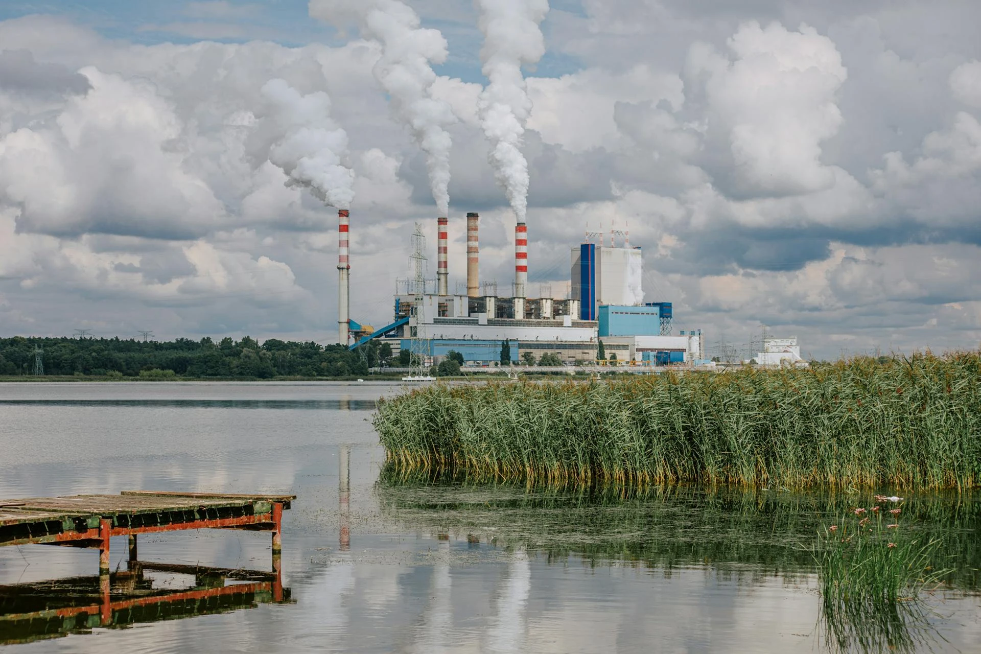
Exposing Coal as the Leading Culprit
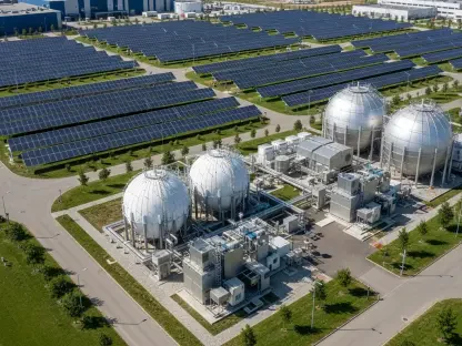
Coal-fired power plants stand out as the most significant contributors to CO2 emissions in the United States, a fact made clear by comprehensive satellite data. Facilities such as the Labadie Energy Center in Missouri, emitting 2.6 million pounds of CO2 per hour, and the Coal Creek Power Station in North Dakota rank among the top polluters, according to Carbon Mapper’s latest database updates. These super-emitters underscore a troubling reliance on coal in certain regions, revealing stark environmental disparities across states. The data paints a grim picture of industrial impact, emphasizing how deeply entrenched fossil fuel dependency continues to challenge efforts to curb greenhouse gas output in key areas of the country.
The implications of these findings extend far beyond mere statistics, serving as a compelling call for transformation. With coal-based energy consistently identified as the primary driver of CO2 emissions nationwide, the evidence gathered from satellite mapping highlights an urgent need to transition to cleaner, sustainable alternatives. Public access to this information via platforms like Carbon Mapper’s online portal plays a crucial role in amplifying awareness. By making emission data transparent and accessible, such tools empower communities, activists, and policymakers to hold industries accountable, pushing for systemic changes in energy production and consumption patterns to mitigate environmental harm.
Navigating Policy Shifts with Tech Solutions
A looming challenge in the realm of environmental oversight is the potential rollback of mandatory greenhouse gas reporting under proposed policy changes by the Trump administration. Such a move could create significant gaps in data collection, reducing the accountability of major polluters through traditional channels. However, satellite and airborne technologies stand ready as a robust alternative, ensuring that emissions remain visible and documented regardless of regulatory adjustments. This technological safeguard offers a practical way to maintain transparency, allowing continuous tracking of pollution sources even if formal reporting requirements are scaled back, thus preserving the integrity of environmental monitoring efforts.
On a global scale, the reach of satellite monitoring holds immense promise for addressing disparities in emissions data. In regions where robust reporting systems are absent, these advanced tools can provide a universal standard of transparency, ensuring that pollution is tracked consistently across borders. With plans underway for Carbon Mapper to expand its fleet by adding three new satellites by the end of next year, the scalability of this technology offers a hopeful outlook for comprehensive worldwide coverage. This expansion could revolutionize how global emissions are monitored, making it impossible for polluters to operate in the shadows and fostering a more equitable approach to tackling climate change on an international level.
Shaping a Transparent Environmental Future
The rapid adoption of satellite and airborne systems signals a pivotal shift in how environmental oversight is conducted, establishing these tools as indispensable in the fight against climate change. Supported by a blend of private innovation, nonprofit initiatives, and governmental collaboration, including data integration from NASA’s EMIT instrument, these technologies are redefining the landscape of emissions tracking. Their growing precision and accessibility empower a wide range of stakeholders—from everyday citizens to top-tier researchers and decision-makers—to engage with undeniable evidence of pollution’s toll. This democratization of data serves as a catalyst for informed action, encouraging broader participation in efforts to reduce greenhouse gas emissions.
Looking ahead, the continued evolution of these monitoring systems promises even greater impact. As satellite fleets expand and data collection methods improve, the ability to pinpoint and address pollution sources will only strengthen. This progress invites a collective responsibility to leverage such advancements for meaningful change, urging industries to adopt cleaner practices and policymakers to prioritize sustainable frameworks. Reflecting on the strides made, it’s clear that the path forward lies in harnessing this technology to build a more accountable and environmentally conscious world, ensuring that the fight against CO2 pollution remains both visible and vigorously pursued.